
About the river.
I am fascinated by the river splitting the city in two parts and creating a huge "terrain vague" in the middle of it. I am fascinated by the contrast between the meaning of this area which is the artery of the city and in the same time being an undefined place.
As a terrain vague, it is a leftover wild space right in the middle of the urban context.
It has its own natural rules.
It seems as if the nature keeps is own right on the area, by deciding, whether it is a part of ground when the river is dry, or an unpredictable river, with risk of flooding. We can feel the tension of uncertainty
It seems as the nature itself is preserving the area of urbanism and that gives the river sites of Santa Catarina an incredible strength.
This place reflects the paradox between connecting and separating:
Looking the urban network around it we can observe that the two sides are separated, but the river was there before. I do not fell that it separates the two sides, but more that it connects the whole area of Monterrey. The separating elements are in the infrastructure of highways. Although they are part of the infrastructure of urban connection, by their design, they separate the city from its river, and they separate the ground from its environment.
San Pedro.
The Area of river Santa Catarina near the Puente de Unidad in San Pedro appears to be an end of urbanism. It is situated at a junction of different urban fabrics; it is also the place for the passage through these fabrics, and the limits between San Pedro and Monterrey.
It is an important passage for the city, as it reflects the situation of an edge and the passage between one type of urbanism to on other (residential versus administrative and industrial). The key elements for projecting a proposal in this site strongly depend on the choice and implementation of a program.
The new Dam, will allow human control on the river. It will bring the opportunity to use the river for permanent and solid uses, and by doing so, it will permit to inhabit the river.
The proposal for a museum is a manifesto using the river permanently.
It is a urban landscape element that uses the river to implement a program, and generates new circulation in the river and t uses the geography and qualities of the river in its architecture.
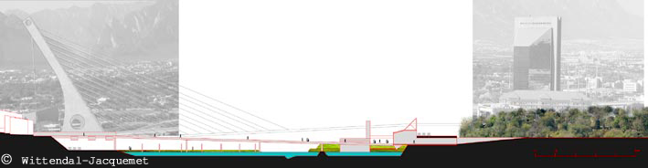
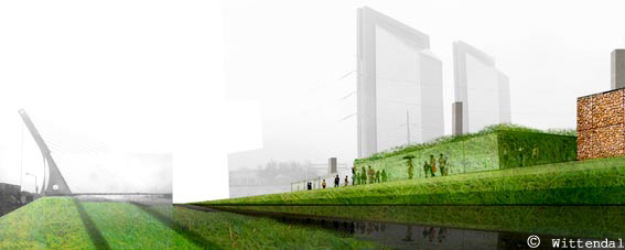
This museum is in the river, on the south side, between the old bridge of San Pedro and the new symbolic bridge of the Union.
The museum is connected by its underground core, beneath the highway to the city of Monterrey, and, on the other side, across the river to the city of San Pedro by a foot-bridge. By doing so, it extends the city of San Pedro to the river. It represents the union of Monterrey with San Pedro.
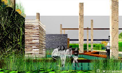
The museum is composed of two bodies: a core body and a floating body.
The core body is a building of 2000m2. It consists of the entrance part and the services of the museum: entrance hall, offices, administration, permanent exhibition, archives and storage. It is situated under the highway, on the south side of the river and connects the river to the existing park and parking. The exhibition part of this core views on the river.
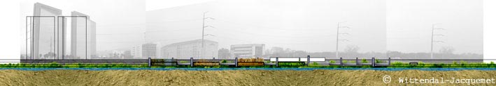
The second body is constituted of exhibition modules of 450m2 each. Four main modules are proposed and each of is covered with a skin that represents a landscape element: vegetation, stone, animal, wood.
Those are floating elements that are connected to the core of the museum through a system of pontoons. This will allow them to move up in the peak flow period and down mainly in the late summer in the base flow period. By doing so, they use the temporality of the landscape and weather in their architecture.
Space along the river bed, may be used for continuation of the linear principles and implementation of other floating modules.
They are protected from the strong flows by a dyke.
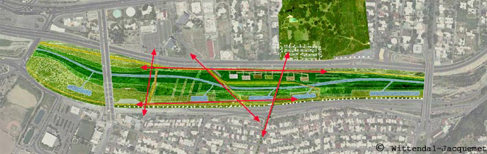
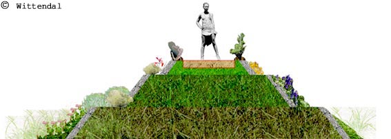
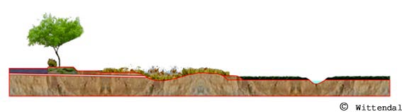
The river bed is treated as a park and functional landscape element, and consists of a network of circulations in the river bed, to the museum and its dyke, and along the river's edges.
It consists of a topography that defines those passages, and creates different levels, used as terraces of vegetation and retention ponds. The ponds contribute to cleaning the runoff water coming from the sloped side of the city of San Pedro before it reaches the river. The terraces are defined to slow down the water flow and create through their different levels a variety of microclimates for wildlife habitats.